Skip to content
154x154_reveal-icon-white-bg.png

REVEAL

REVEAL charts bring you the very best of C-MAP, including game-changing Shaded Relief – bringing the world around and beneath you to life in a completely new way – now available everywhere.

CORE FEATURES

Every REVEAL Chart includes:

  • Full-Featured Vector Charts
  • Detailed Marina Port Plans
  • Shaded Relief
  • Dynamic Raster Charts
  • Hi-Res Bathymetry
  • Aerial Photography
  • Integrated Genesis Layer
  • Satellite Overlay
  • Custom Depth Shading
  • Subscription-Free Easy Routing™
  • 12 Months’ Free Updates
  • Tides & Currents

SHADED RELIEF

reveal-shaded-relief.jpg
Bring the world around you to life, with 3D rendered land and underwater elevation – including select areas of Ultra-High Res Bathymetric imagery previously only available in MAX-N+ Reveal – a game-changer for anglers and divers.
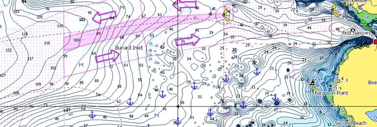
FULL-FEATURED VECTOR CHARTS

discover-vector.jpg
Full Featured Vector charts make navigation easy by giving you accurate, up-to-date vector chart detail derived from official Hydrographic Office information.

HI-RES BATHYMETRY LAYER

discover-hrb.jpg
High-Res Bathy helps you identify shallow areas, drop offs, ledges, holes or humps by accurate contour lines down to 1-foot level of detail. Includes the very best of C-MAP HRB data, including C-MAP Team Lake Surveys (US only) and Genesis® social maps, quality controlled and fully integrated.

CUSTOM DEPTH SHADING

discover-depth-shading.jpg
Custom Depth Shading allows you to set a safety depth, maintain a paper-like view or set your own custom shading – see things your way.

SATELLITE OVERLAY

reveal-satelite-overlay.jpg
Satellite imagery gives information about the surroundings when you find yourself in an unfamiliar place.

AERIAL PHOTOS

reveal-aerial-photography.jpg
A collection of thousands of photos of marinas, harbors, inlets and other notable navigational features included to offer an additional level of detail.

DYNAMIC RASTER CHARTS

reveal-raster-charts.jpg
Providing the traditional chart look and feel, coupled with easy access to all objects on the chart.

EASY ROUTING

discover-easy-routing.jpg
Easy Routing helps you automatically plot the shortest, safest route based on detailed chart data and your personalized vessel information. With C-MAP Easy Routing is always subscription free.

TIDES & CURRENTS*

discover-genesis-tides-and-currents.jpg
Tides & Currents show projections of water level and direction of tides to help plan your day out, whether cruising, angling or sailing. *only available with Coastal charts

DETAILED MARINA PORT PLANS

reveal-marina-port-plans.jpg
Docking in an unfamiliar port is no problem, when you have precise layouts of thousands of marinas, including slip spaces, restricted areas, and other valuable navigation information.

12 MONTHS’ FREE ONLINE UPDATES

Keep your chart up to date, with 12 months’ free online updates.


COMPATIBLE WITH B&G, SIMRAD and LOWRANCE CHARTPLOTTERS

Check if REVEAL is compatible with your Chartplotter.

COVERAGE

C-MAP data and features you want, with coverage options ideal for each budget and boating need. Whether you’re a long-distance cruiser, avid angler or sailing enthusiast - C-MAP has you covered. Find out more about C-MAP Chart Features.