News Archive
Recent news and features
Cartography updates
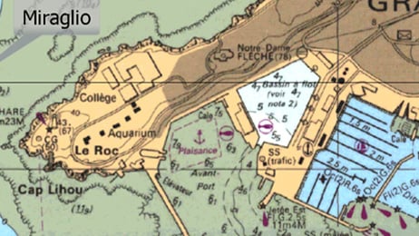
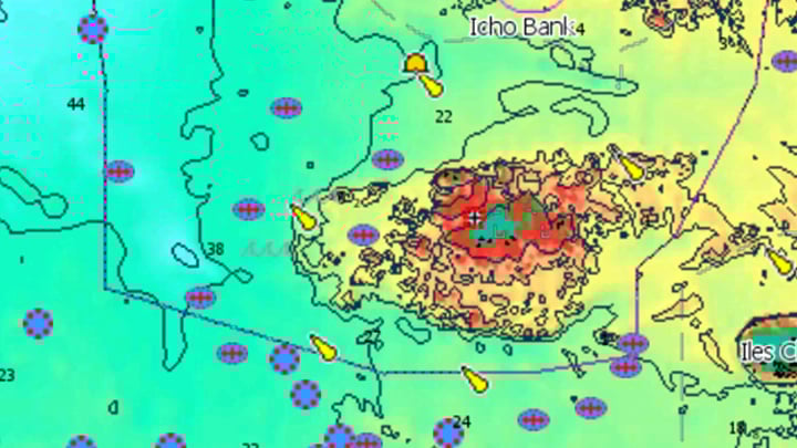
CMAP Announces Significant Chart Enhancements for the Irish Sea, Land’s End, and Central Europe
First major European chart update of 2026, delivering significant enhancements for recreational boaters.
Removal of Raster Layer from C-MAP Reveal and 4D
Effective immediately, C-MAP will no longer offer Raster Charts as part of our offering for Reveal and 4D Charts.
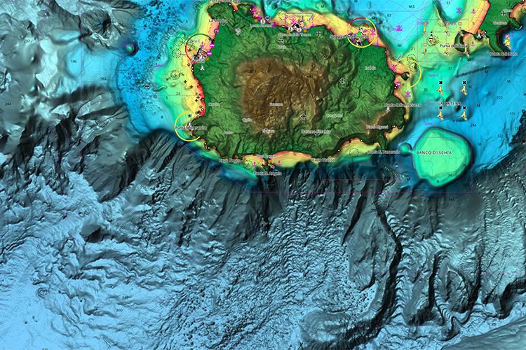
C-MAP Rolls Out Enhanced Charts Across Europe
New update improves cartography across DISCOVER, REVEAL and X Generation charts and introduces ENC-only mode.

C-MAP® improves coverage across UK, France, Denmark, and Portugal
Updates include an additional 40 lakes added across France, Denmark, and the UK.
C-MAP® Expands Coverage across UK, France and Spanish Coastlines
C-MAP® today unlocked uncharted waters by expanding coverage across inland France, UK and Ireland, as well as improved coastal bathymetry around Spain.

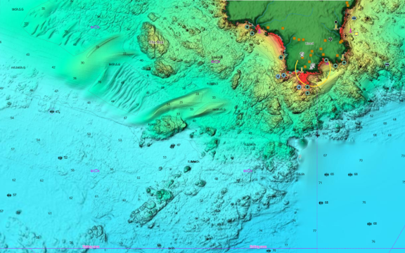
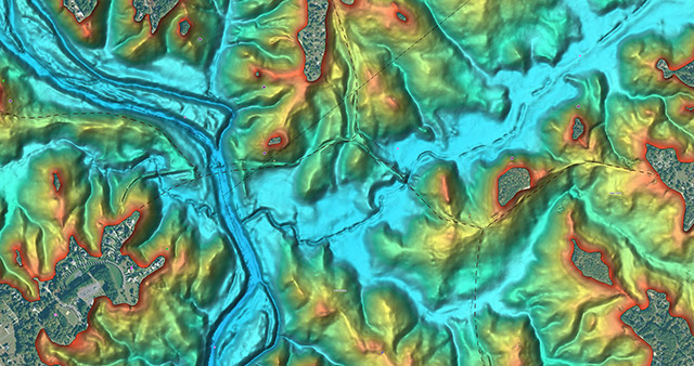
C-MAP® Updates Cartography for Europe
Major update to European charts – includes improved High-Resolution Bathymetry and Shaded Relief across parts of coastal Europe and South Africa.

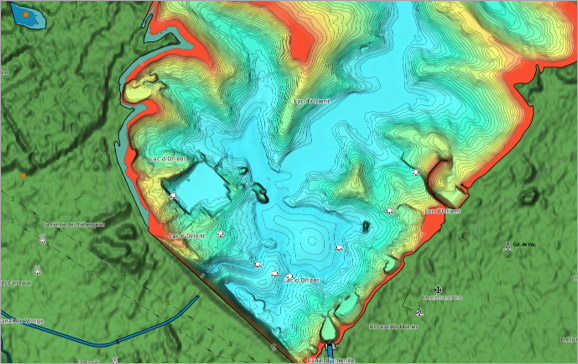
C-MAP® Debuts NEW Inland Cartography for the Netherlands
C-MAP® Debuts NEW Inland Cartography for the Netherlands
Features
Update for C-MAP® App Including New Features
New features open community sharing and anchor alert for all users, with satellite and weather overlays for Premium users.
Download a Complete Guide to C-MAP® Chart Symbols (PDF)
Learn what all the icons, symbols and objects mean on C-MAP charts. From anchorage areas to submerged wrecks, it's all on the map.

E1 Series Powerboat & C-MAP Partnership
C-MAP® has partnered with the E1 Series to become the Official Cartography Partner of the world’s first electric powerboat championship.

Navigational Newbies
C-MAP® offers an excellent way for novice boaters to safely discover their new favourite waterways.


