The world's best community-sourced maps
Compatible with Lowrance®, B&G® and Simrad® units.
Compatible with Lowrance®, B&G® and Simrad® units.
C-MAP® Genesis® charts have revolutionized freshwater fishing, and also offer huge advantages to saltwater anglers.
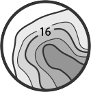
Through user-generated data, precise 1-foot contour detail is available for once uncharted water systems. With features such as custom depth shading, vegetation and bottom composition layers as well as live mapping, C-MAP Genesis will help you find more fish and navigate new water safely. For best accuracy and precision, data uploaded via Genesis Social or Genesis Edge is quality checked by our team.

With C-MAP Genesis, create your own high-definition custom fishing maps for your favorite waterbodies.

With over twenty thousand active bodies of water and counting, download free maps of your favorite water-bodies.
Genesis creates high definition fishing maps from sonar and GPS position recordings with compatible Lowrance or Simrad devices on your boat.

With automatic mapping of the bottom after you start recording (.sl3, .sl2, .slg), and a simple sonar log upload process to the cloud when you log into genesismaps.com, you’ll be creating charts in no time.

With custom depth shading, quickly identify fish-holding humps and dangerously shallow areas.


